Tag: <span>Drones</span>

Extending the Life of your Drone

By Malek Murison.

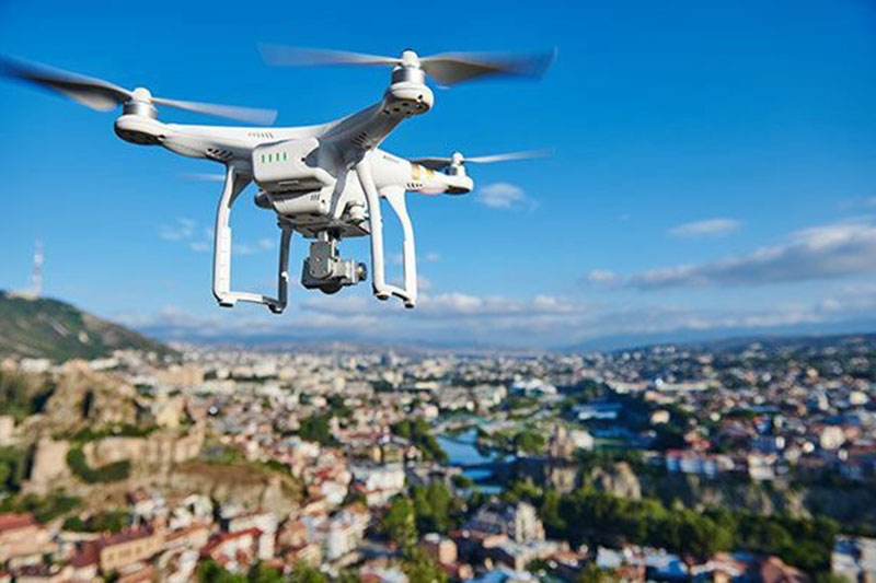
Drones are not like mobile phones. Ideally, you don’t want to be buying or upgrading to a new model every year. Instead, look at it as an investment in your aerial photography skills: the best way to reap the rewards is to keep your drone in great shape and performing to the max for as long as possible.

Think about coverage

The first thing you should do after buying a new drone is to organize some kind of cover. Things can (and probably will) go wrong at some point. The last thing you want is for your $1,000 gadget’s value to plummet down to $0.

Your best way to stop that from happening is to arrange insurance. Better still, most manufacturers offer coverage for the first year. For example, DJI’s Care Refresh package can be bought alongside a new drone to give you peace of mind and practical support in case you crash or damage your drone.

The company will attempt to get it working again or supply you with a new model.

Keeping on top of pre-flight checklists

Once that first year is through, most coverage policies will run out and regular insurance will be your best bet.

But besides that, you can extend the life of your drone by developing a flight routine based on care and accident prevention.

The best way to do that is to stick rigorously to a comprehensive pre-flight checklist. Keep on top of the status of your drone and avoid flying if there are any obvious problems or faults.

Keeping your drone safe when it’s not in use

As a drone pilot, one of the most frustrating things that can happen is your gear getting damaged when it’s not even in use.

Taking care when charging, installing updates and storing your drone is the best way t stop that from happening. Find as sturdy a case as possible to store your drone, and keep it out of the way of kids, pets and the elements.

Looking after drone batteries

A question plenty of pilots have is how to extends (or at least maintain) the life of drone batteries. Every second counts when you’re up in the air, so keeping your batteries performing to the max is essential.

Most drone manufacturers state that lithium polymer batteries should be stored at a temperature of between 5ºC and 27ºC. The lower the temperature the better, in fact. If they are being packed away for the long term, battery experts recommend making sure they have around 40% of charge.

When it comes to charging, the most common way to damage a LiPo battery is by overcharging it. So once your batteries hit 100%, unplug them. Experts also suggest that letting your battery drain to 0% on a regular basis will reduce its life in the long term.


Buying new batteries for your drone is usually an expensive process. Taking a few easy steps can help keep yours in good condition.

Practicing in something expendable

The majority of crashes and accidents happen when drone pilots are new on the scene or when complacency creeps in. So the best way to keep your valuable gear intact is to grow in confidence and gain more experience behind the controls.

For those in the former category, it’s a good idea to try your hand at flying something cheaper and relatively expendable. There are plenty of drones for beginners out there that won’t break the bank. You can also check out our post on the common mistakes drone pilots make to learn from the mishaps of others.

Interested in finding a drone that can extend your flight time, too? Check out this rundown of which drones stay in the air for longest.

Note: This blog first appeared on RT3 member Drone Base’s blog and can be viewed here.

Top Uses of Aerial Imagery and Web-based Tools

Contractors are quickly discovering the ways that aerial imagery can help them unlock new opportunities, cut costs and gain a strategic advantage.

Here are the top ways that contractors are leveraging the power of aerial imagery, according to Nearmap:

  1. Search and navigate – The search bar allows contractors to identify specific address, locations or points of interest and then quickly pan, zoom and navigate around the area. Nearmap constantly updates its imagery which means you won’t be sending crews onsite based on outdated information. Verify field reports, surveys, boundary lines and other data sources.
  2. Proposal development – High-resolution imagery can be used in proposals that create a professional presentation where you can emphasize the important details that you want to communicate.
  3. Targeting – identify more leads and target specific areas. The imagery shows unique characteristics of properties
  4. Communication – strengthen what teams can accomplish through better reports, board presentations and annotated communications.
  5. Measurement – accurate measurement data for estimates, quotes, and planning.
  6. Change detection – historical imagery for monitoring change, verifying what happened when, or viewing different times of the year.

Editor’s note: This article first appeared on RoofersCoffeeShop.com and can be viewed here.

How technology is changing what it means to be successful in the roofing industry

By Nate Stein, AccuLynx.

The roofing industry is changing right before our eyes; advancements in new technologies, building trends towards sustainable materials, more safety regulations, and the way we communicate with our leads and customers have all evolved from a simple paper to pencil business model. As these new models continue to invade and improve the roofing and contracting industries, business owners now have a greater stake when it comes early adoption and practical application of new tools and technology as they come on the market.

Using Technology to Help Manage Your Business Workflows

As a roofing business owner, you are constantly tracking new leads through your sales teams on a daily basis, and that volume is directly related to new business you manage every year. While the potential to complete more jobs is exciting, keeping track of all your projects can be a headache – not only for managers, but for office staff as well. Scavenging through your rolodex, cell phone or filing cabinet is a time-wasting activity that doesn’t actively help you be more organized. Investing in business management software specifically built for contractors like a CRM (customer relationship management) or ERP (enterprise resource planning) can streamline your customer acquisition and retainment process, while also allowing you to manage all of your finances and document management for your roofing business.

With a cloud-based data system, you eliminate the possibility of ever losing a customer’s information, while gaining unlimited access to the files and documentation your field staff need on a daily basis. Various departments in your business no longer need to refer to different databases, with out of date or conflicting information. All information is stored in one, centralized location, ensuring everyone has the same, accurate data.

ERPs give you the ability to manage the “business” side to your business, with integrations to procure supplies from your local branches, enter data and manage commissions, supplements and financial tracking with QuickBooks, and create estimates, contracts, and other necessary paperwork for jobs with the click of a button.

Business management has come a long way from Excel and carbon copies – roofers that take advantage of software have seen impressive returns on their ROI.

“It’s valuable to look not only at how quickly the company will gain back the initial investment in terms of cost-savings, but also at the number of man-hours the estimating team will save. When software reduces the number of hours spent estimating a project, it frees up time to bid and win more projects—which can multiply revenue many times over. [source] “

Take Flight with Drones & Aerial Roofing Measurements

Gravity no longer limits your abilities as a roofer. With aerial measurements and drone image capturing, you as a roofer have the option to expand your estimating and ordering capabilities through improvements in the way you approach any roof. Companies such as EagleView and SkyMeasure simplify the measuring of roofs. Instead of having your field staff climb on top of roofs all day and manually measure slopes and areas, you can place an order for an aerial roof measurement, automatically populate estimates and produce more accurate paperwork to homeowners and material suppliers.

Drones are also continuing to alter the roofing landscape. Equipped with 4K cameras, personal and professional roofing drones can fly over homes and capture detailed pictures of problem spots, which your sales team can then show to your leads in order to better visualize and explain issues and communicate with homeowners. Better yet, these drones can also be used to snap pictures of potential hazardous spots on roofs, so your crews can be well informed and prepare before they set a single foot on a roof again.

Direct Connections and Integrations with Material Suppliers

How have you been ordering your shingles, nails, and gutter coil up until now? Well, just like most every other roofer out there, you probably picked up the phone, made a call to the sales rep at your local branch, chatted for a few minutes, and then went on to ordering supplies for your roofing project. The all-too-classic happens, when you ordered black shingles, but you received brown ones, and those 1” nails you ordered ended up arriving as 1 ¼” nails.

While mistakes happen, it is annoying and unnecessary in today’s technologically advanced roofing world. Now, you can place orders with your local vendors online. New software tools allow you to browse different products that your supplier offers with real-time prices. From GAF Timberline Shingles to endless house wraps and sealants, you can order anything you need for all your roofing jobs. Real time pricing ensures you get up to date prices, so you can build accurate estimates. With supplier-direct ordering, you won’t receive those brown shingles and 1 ¼” nails you never ordered, and you can show your prospect an accurate estimate of what the project will cost.

The roofing industry is changing – processes that were once tedious, annoying, and time-consuming have been streamlined and automated by software and technology that help your business operate more efficiently across all of your teams. Embracing the dynamic changes happening today may seem overwhelming and impossible to keep up but provide limitless potential as you continue to scale and grow your business.

Note: This article first appeared on the AccuLynx blog and can be viewed here.

Choosing the right drone solution – a drone buyer’s guide

Drones and unmanned aerial vehicles (UAVs) are quickly shaping up as the built industry’s can’t-live without, next generation of tools. But not every contractor needs a full in-house team of pilots. And not every sub wants to own their own drone. With so many UAV solutions out there — what questions should firms be asking themselves when evaluating the software, hardware, and professional services out there?

BuiltWorld’s talked to 8 of the leading companies in the drone services industry to find out. Here are a few of their tips.

Remember: All pieces must fit together.

When evaluating drone solutions, you’ll quickly find that each company offers something different. Some provide training. Others, consulting and the drones themselves. And others still, software and machine learning.

But don’t forget: “The drone, flight planning software, data processing software, data management and analytics tools, and pilot operations have to all fit together,” says Dick Zhang, Identified Technologies CEO. “If any link in that chain is broken, your data is wrong.”

The Kespry team also pointed out the same issue: “If you decide to piece together your own system of drone, be aware that there can be significant technical challenges in getting parts of the system to talk to each other. If you have multiple providers, understand who you call to solve the different technical issues you may run into.”

Determine the Value

Making a business case will ensure you’ve made the right investment. Dan Cipriari, CEO at Pointivo, asks clients to consider the ways they can monetize the data they capture with the drone: “Can they use photos to conduct inspections? Generate a 3D model to pull into software? Extract measurements for claims or estimations? Once they understand how they want to use the drone, they can make the decision on who to partner with and how to integrate drones into their business processes.”

BetterView CEO David Lyman suggests trying services before making any capital decisions: “Explore thevarious options for capturing, analyzing, and utilizing data that is compatible with your business and budget. Consider working with a service provider to test the options, even if you think the best long-term solution is an internally owned and operated model.”

Download the complete Drone Buyer’s Guide.

5 Construction Technology Trends to Watch in 2018

By Karen L. Edwards.

Technology is advancing at a fast pace and each year brings new solutions to the construction table.

Leaders in the industry will be those who embrace the use of technology and pay attention to these emerging technologies.

  1. Virtual and augmented reality

Virtual reality technology allows individuals to “see” what a built environment will look like which is especially useful for proposed new construction projects. Allowing someone to visualize and experience the project can go a long way in building confidence for all involved in the project.

Augmented reality is similar to virtual reality except that the it involves walking through a real 3D environment while viewing additional real-time information about the environment. For example, if a building owner wanted to create a rooftop garden area with various features, augmented reality would bring the roof to life – before the project starts. It will allow that owner to stand on the roof and see what the existing roof would look like with the addition of the garden roof features.

  1. Online Jobsite

New technologies are eliminating the delays in communication that can occur between the job site, the office, the installers and the rest of the project team. Job site connectivity is becoming easier to achieve with the use of connected smartphones and tablets that can send and receive information in real time to everyone involved in a project, including the building owner.

  1. Wearable Technology

There is a new company that offers wearable tags that allow contractors to improve and advance the safety of their workers on the job site. A clip can be attached to workers’ belts that tell you when someone slips, trips, or falls and alerts you to what zone of the job site they are in. They also offer an equipment tag that links to the belt clip to tell you who is operating the equipment and delivers statistics on how the equipment is being used.

  1. Drones

The drone industry is exploding and there are so many uses for drone technology in construction. They can be used to map project sites, report project progress and changes, update clients and inspect damage following severe weather. Companies are popping up every day that offer drone services which means you don’t have to master flying one.

  1. Robotics

Robotics haven’t shown up on the rooftop – yet. But they will. They are already being used to lay bricks – at a pace six times faster than a human. This video of the SAM100 bricklaying robot shows how the technology works faster and eliminates the lifting and bending that can create problems and potential injuries for workers.

Companies in the construction and roofing industries need to get on board the technology train or risk being left far, far behind the rest of the market.

Note: This article first appeared on RoofersCoffeeShop.com’s blog and can be viewed here.

Feazel Reinvents Roof Estimation Process for Customers by Leveraging VR Technology

New technology tool takes the hassle and inconvenience out of roof estimates.

Feazel Inc., Columbus’ leading exterior home improvement contractor, is giving customers control over their next roofing project with the release of Robyn, a virtual guide for roof replacement quotes.

Currently, obtaining an estimate for a full-roof replacement requires an in-person appointment with a sales-person, likely during normal working hours. This inconvenience creates frustration and can make the process difficult for the customer. Feazel is set to transform that process for the industry with Robyn, which provides customers a virtual quote for their roof replacement and eliminates the need to meet with a salesperson.

“We know that replacing a roof isn’t something people do for fun. Most of the time, it’s an investment they’re not looking forward to,” says Leo Ruberto, president of Feazel. “The process is bogged down with timelines and negotiations, and we’re looking to eliminate that for customers. Robyn will allow a customer to get an estimate at their convenience, on their time, and at a more comfortable price.”

With Robyn, customers request a quote online, prompting a drone operator to go out to the property and take high-resolution images of the roof. During that time, the operator will leave behind virtual reality goggles designed to be used with any smartphone. By using the images and industry-leading applications, Robyn is able to estimate the materials and costs necessary to replace the roof. The customer will then receive an email with their project quote, as well as a virtual reality tour and educated guide of the Feazel roof replacement process.

Customers will also have the ability to use a custom roof visualizer, which allows them to view a three-dimensional model of their home and scroll through different shingle styles and colors for their roof replacement.

“The best part about the process is that this reduces the overall project cost for the customer, something we’re very excited to bring to the table,” Ruberto said. “While Robyn is a different element in the beginning phases, Feazel will still offer our same signature quality to the project, including our Lifetime Warranty, Price Match Guarantee, and 12-months same as cash financing.”

Should Feazel customers not be interested in the new technology and Robyn, Feazel will continue to provide the option of setting up an appointment with a salesperson for an in-home inspection and live discussion.

Robyn will be unveiled to customers for the first time at the Columbus Spring Home and Garden Show, February 17 through February 25 at the Ohio Expo Center.

About Feazel

Feazel has been providing quality exterior home improvement services since 1988. With a commitment to deliver the best customer service and a stress-free buying experience, Feazel offers roofing, windows masonry, siding, ventilation, gutters and more. Headquartered in Columbus, Feazel also has locations in Cincinnati, Cleveland, and Raleigh, NC. The company also plans to expand into the Dayton, Ohio, and Indianapolis markets in 2018. Learn more at feazelinc.com.

SOURCE Feazel Inc.

3 Ways Drones Are Used on Construction Worksites

Drones are quickly becoming the preeminent solution for delivering aerial imagery for construction projects.

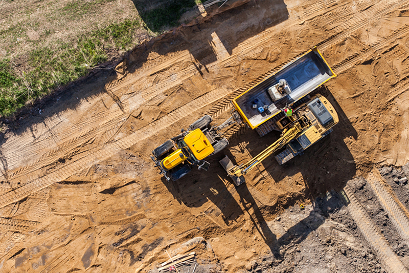
As regulations ease and technology continues to improve, the use of drones for monitoring and reporting on construction projects is steadily increasing. Here are just 3 of the most popular ways drones can be used on construction worksites.

Progress Reports

Rome wasn’t built in a day…and neither were any major land development projects. There are various checkpoints throughout the construction process, which in most cases can take months (if not years).  Leveraging a drone for an aerial progress report allows for real-time updates, so project owners can save time and manage worksites more efficiently.

Inspections

Using drones to complete full-scale inspections significantly reduces the risk factor for workers. Rather than a worksite manager conducting a time-consuming and somewhat hazardous inspection, a drone operator can capture a birds-eye view of the entire area safely & within a much shorter timeframe.

Analytics

Drones can assist in providing accurate estimates, generating cut and fill maps, modifying plans to meet on-the-ground conditions and more …all in a matter of clicks. The availability of rich analytics gives customers a more accurate understanding of their worksite.

This article first appeared on the Drone Base blog and can be viewed here.

Drones Helping Building Owners Assess Damage, Prioritize Repairs and Monitor Job Progress

DCIM100MEDIADJI_0502.JPG

National Roofing Partners (NRP) has implemented the use of drones as part of its continued commitment to incorporate the latest technologies into its operations.

Hurricane Maria devastated Puerto Rico in the Fall of 2017, leaving the island in the dark and national corporations unable to communicate with their facility managers to determine the extent of damage to their properties. One of NRP’s client, a large national retailer had 12 locations on the island and needed a way to survey the damage to their buildings to prioritize and schedule repairs.

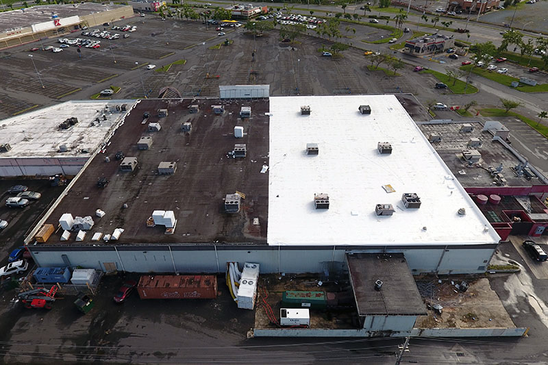
NRP partnered with a drone service and sent teams onto the island to conduct assessments of their client’s properties. By capturing that aerial view NRP was able to show their client the extent of the damage so they were able to evaluate and prioritize repairs. The buildings that had obvious visible damage such as holes in the roof were elevated to the top of the repair list.

Re-roof in progress.

Once repairs were underway on the roofs, NRP delivered weekly progress reports utilizing the aerial drone imagery. NRP Senior National Account Manager Mallory Payne said that the use of drone imagery has provided the client a clear understanding of how the repairs are progressing. “Before using drone imagery, we relied on contractors to send us photos but they were taken on the roof, which isn’t always the best angle for a true understanding of job progress,” explained Payne. “The drone imagery is captured from above and provides a view of the entire roof where is it easy to see exactly what has been completed and what is still left to do.”

The use of the drones in Puerto Rico went so well that Payne says NRP is making it a standard operating procedure. “Previously, we used to send clients progress reports using a drawing of the roof and marking it up with comments as to how the job was progressing,” said Payne. “Now we just send them a link and they can view the photos of the work from any web browser.”

There were some kinks to work out in the beginning since the drone flyers that NRP is working with are not experts in roofing, they are experts in drone operations. Payne worked on developing three different types of flights with specific instruction on what to photograph on each project. Those three types include HVAC equipment flights, aerial overviews with individual roof section images captured and project progress flights.

Re-Roof in progress, almost complete.

Since determining the types of photos needed and developing the three flight types, the drone technology has been a key part of every project.

Drone Photogrammetry Test: Are Automated 3D Roof Measurements Accurate Enough?

By Dan Ciprari, CEO and Co-founder, Pointivo Inc.

Roofing is one of the earliest construction segments to begin adopting the use of UAS technology for gathering measurements.

The use of unmanned aerial systems (UAS) has grown tremendously in just a few years. Consulting firm PwC noted in its 2016 PwC Global Report that the global market for business services using this technology is valued at more than $127 billion. The report notes that the largest single application is infrastructure, valued at $45.2 billion. As the use of UAS continues to advance, construction companies stand to benefit the most, as these solutions offer improved safety, lower costs, and better workflow integration to convert data into actionable insights.

Roofing is among the earliest construction segments to utilize UAS technology. When roof measurement reports based on aerial imagery first appeared approximately 10 years ago, the precision and reliability of aerial-based measurements were still unclear. The debate about accuracy continues, even while UAS-generated measurements have shown they can be much faster and eliminate the potential for injury during manual measurement.

Haag Engineering, a forensic and engineering consulting firm, recently completed an independent accuracy study to validate the precision of UAV-based roofing measurement workflows. These processes use intelligence algorithms to automatically extract roof geometry and measurements from unmanned aerial vehicle (UAV) imagery. The results were then compared to manual measurements.

How Haag Engineering conducted the test

Experienced field surveyors independently measured 13 roofs using traditional survey methods, while independent pilots flew autonomous Kespry UAVs over these roofs to capture images and generate 3D models.

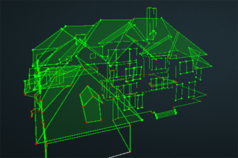
The Kespry UAV was part of a proprietary UAS platform, which included autonomous UAV flight and the capture of high-resolution imagery, as well as 3D processing in the cloud. Once the 3D data was generated, it was then transferred to a 3D intelligence platform where computer vision and machine learning algorithms detected the roof structure, classified edge types, and extracted accurate geometry and measurements for the entire roof, and then generated a detailed CAD model.

These automated measurements–which included lengths for each roof edge, area and pitch for each roof plane– were then compared with the manually collected measurements. Automated measurements were rounded to the nearest millimeter and manual measurements rounded to the nearly ¼ inch, even though measurement to the nearest inch is a typical industry practice.

The roofs

Roof pitches ranged from flat to 12:12 and individual roof areas spanned approximately 10 to 62 squares.  The test included 17 buildings, totaling approximately 535 squares (one roofing square equals 100 square feet). Four of the roofs were too unsafe to measure and were verified through conventional reporting. All sloped roofs were asphalt composition shingles, the most popular type of sloped roofing in the U.S. Flat roofs were modified bitumen. All properties were located in the Dallas-Ft. Worth Metroplex.

Average variations fall well within industry benchmarks

When comparing roof area (See Figure 1), the Haag Engineering study found that for the 13 roofs that were measured, variations between the manual and automatic measurements ranged from +1.2 percent to -2.7 percent per individual roof. The average difference of 0.6 percent was within the industry goals of +/- 2 percent.  When comparing differences in absolute values, the average variation was 1.1 percent, still comfortably within the +/- 2 percent range.

Automated measurements were highly accurate on edge lengths when compared to manual measurements, and were thus shown as providing highly accurate area results.

It should be noted that these tests used GPS data gathered from sensors on the drone itself to provide scaling data. In the future, accuracy can be improved further by utilizing more precise scaling methods like ground control points (GCP’s) or RTK GPS when the need is required.

Detailed Results

The greatest roof area difference was 95 square feet (2.7 percent of the roof area) while the smallest was just 3 square feet (0.2 percent).  The roof with the greatest difference—#6—was covered by overhanging tree branches along its front edge.

Roof #9 contained a flat roof section that measured approximately 17 squares and was partially overhung by the adjacent sloped roof. However, the automated computed area for this flat roof section was still within 1 percent of the manually-calculated area.

Conclusions

Haag Engineering’s final report summed up the results well: “The automated solution proved reliable for the 13 roofs sampled, as the total area computed 99.4% accurate on average.” These results have proved the UAS can be a viable option to capture accurate roof measurements from the safety of the ground.

Furthermore, UAS enabled much faster measurement than manual means, and much safer. In fact, the original intent of the study was to measure 17 roofs, but 4 of the 17 were too slick and/or steep to reliably measure manually, without better weather and/or a rope and harness. These roofs were easily measurable by UAS.

As UAS technology continues to advance and 3D intelligence platforms become a mainstream solution, construction firms will find an increasing number of uses. Improved accuracy, enhanced safety, lower costs and improved analytics of UAS-generated data will make these solutions increasingly attractive in a wider range of applications.


Note: This article first appeared on the SPAR 3D website and can be viewed here.